Ground Penetration Radar is for civil engineers, geologists, and geotechnical engineers looking for a more efficient, effective, and reliable way to investigate subsurface features in the ground. Look no further than ground penetration radar (GPR), a revolutionary and versatile technology capable of capturing data with applications across an array of industries.
This article is dedicated to introducing the fundamentals of GPR and its potential to improve your work. You’ll leave with a better understanding of the benefits of GPR and insight into how to get the most out of your surveys.
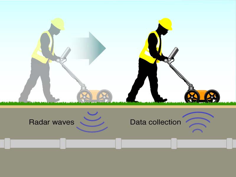
GPR is an electromagnetic wave technology that works by emitting a pulse of energy into the ground and analyzing the reflections that come back. The energy waves travel through different materials at different speeds, so by measuring the travel time and the amplitude of the reflections, Ground Penetration Radar can create images of the subsurface.
GPR is non-destructive and relatively quick, making it ideal for applications where traditional methods would be too invasive or time-consuming.
GPR offers higher penetration depth than other non-destructive techniques such as infrared thermography, ultrasonic, or microwave, and may thus identify concrete defects or deterioration at deeper depths.
The GPR survey technique involves transmitting electromagnetic energy into the ground and recording its reflections. The amplitude of each reflection is influenced by many factors, including the type of material, its depth, and the amount of moisture present. The recorded data are then plotted on a map to produce an image that contains information about subsurface features.
The recorded electromagnetic energy may be reflected from man-made objects such as pipes and cables or from natural objects such as bedrock, soil, minerals (ores), water, and vegetation.
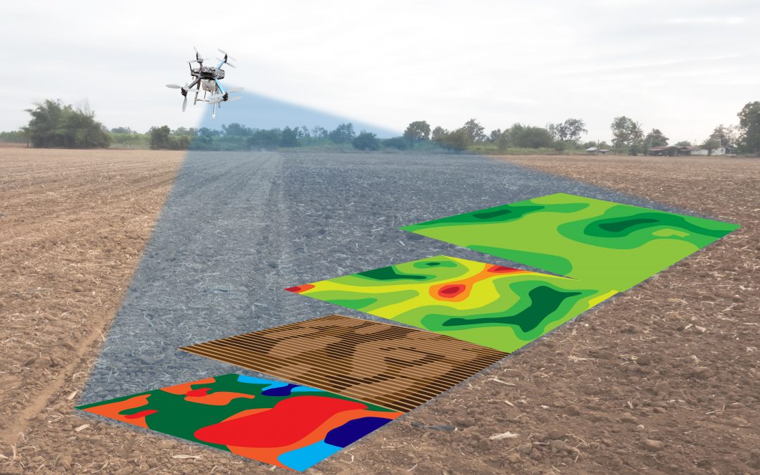
The Ground Penetration Radar survey technique is often used in conjunction with other geophysical techniques such as magnetics to provide a more complete subsurface image. GPR surveys have been used extensively for many applications including geotechnical engineering, environmental monitoring, archaeology and construction management. This article presents some examples of typical applications in these fields.
GPR surveys can be used for a variety of purposes, but they are particularly useful for mapping buried utilities, locating voids, and detecting changes in soil properties. GPR can also be used to assess the integrity of concrete structures and to locate reinforcement bars. In the environmental field, GPR is used to map landfill lids, locate leaks in containment walls, and delineate buried contaminants.
GPR can help to find lost objects, buried treasures and build structures. In properties we can detect what is the material in walls or digging ditches for the drainage. We can study tumors in our body and coatings of drugs and materials on pills. Next: Because of these advantages, Ground Penetration Radar is used in many areas including archeology, construction engineering, civil engineering, soil analysis etc.
There are a few things to keep in mind when conducting a GPR survey. First, the waves will be reflectionless if they hit a feature perpendicular to their propagation path. For this reason, it’s important to ensure that the survey area is large enough to allow the waves to hit features at a variety of angles. Second, GPR surveys are typically conducted in straight lines. This is because the data is collected in two dimensions, so if the survey area is too large, it can be difficult to interpret the data. Finally, GPR surveys are most effective when the ground is dry, so it’s important to avoid wet conditions if possible.
![Tunnel Design [a guide to designers]](https://www.structuralguide.com/wp-content/uploads/2019/11/Tunnel-1-1024x599.jpg)